
Georeferenced Word-Clouds for Health Research
🔍 Mapping Emotions: How Teens Feel in Their Cities
Have you ever wondered how the places we visit shape our emotions? In our latest research, we set out to explore exactly that—by mapping the feelings of teenagers as they moved through their daily lives. Using a combination of GPS data and personal narratives, we created georeferenced word-clouds that visually capture how adolescents feel in different locations across their cities. This isn’t just about understanding emotions; it’s about helping urban planners, educators, and communities create spaces that foster well-being and happiness.
🛠️ How We Did It: Tracking Teens’ Lives
We worked with 155 teenagers from four Illinois cities, asking them to wear GPS trackers and keep detailed activity diaries for four days. These diaries included open-ended narratives about how they felt during each activity. Imagine a teenager walking to school, hanging out at the park, or shopping downtown—each moment was captured with a timestamp and a story.
Using advanced tools like ArcGIS and R packages, we processed over 775,000 GPS points and 2,096 narrative entries. We matched each narrative to its corresponding GPS location, creating a grid system to analyze word frequency and sentiment. The result? A georeferenced word-cloud that visually represents the emotions tied to specific places.
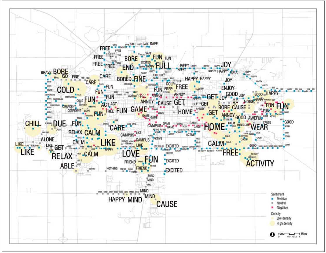
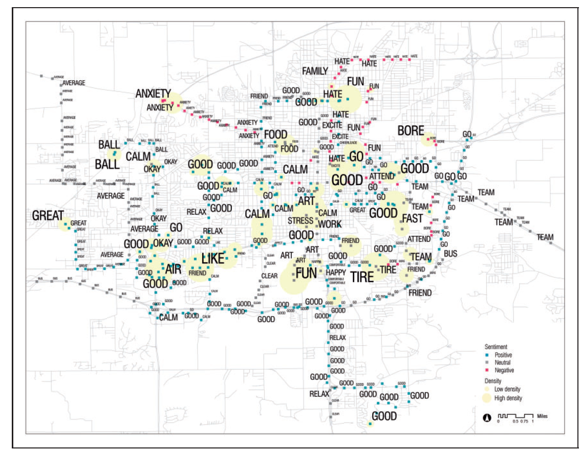
📊 What We Found: Stress at School, Calm in Parks
Our findings revealed fascinating patterns. In both Champaign-Urbana and Springfield, areas near high schools were hotspots for words like “stress” and “annoy.” On the flip side, parks and open spaces were associated with feelings of “calm” and “relax.” Commercial areas, like shopping districts, often evoked words like “good” and “fun.”
For example, in Champaign-Urbana, downtown areas and school neighborhoods received the most narrative comments, while Washington Park in Springfield stood out as a place of positivity and calm. These insights aren’t just interesting—they’re actionable. Urban planners can use this data to design spaces that reduce stress and promote well-being.
💡 Why This Matters: Building Better Spaces for Everyone
Our research isn’t just about teens—it’s about creating cities that work for everyone. By understanding how people feel in different spaces, we can design urban environments that promote mental health and happiness. Imagine schools with more green spaces to reduce stress, or parks designed to maximize relaxation. The possibilities are endless.
Looking ahead, we see this method being applied to a wide range of studies—from travel behavior to social media research. By combining GPS data with personal narratives, we can uncover the hidden emotional landscapes of our cities and use that knowledge to build a better future.